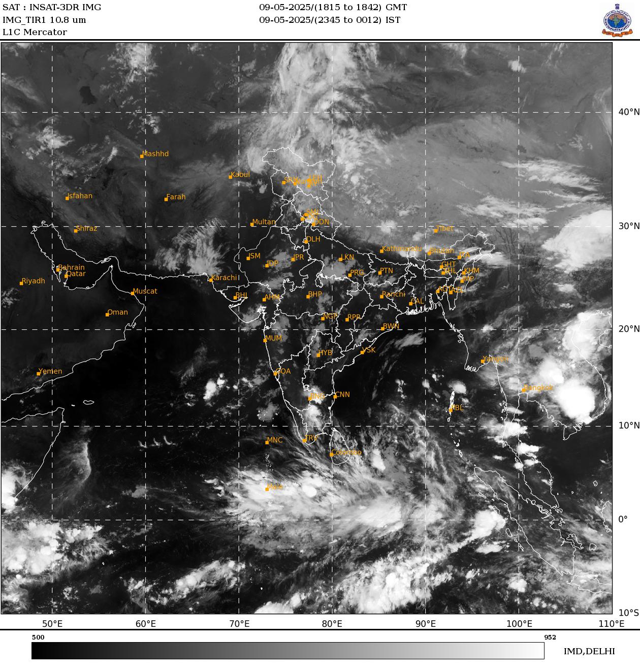
As of August 9, 2025, several weather systems are influencing conditions across India. The monsoon trough is positioned close to its normal spot at mean sea level. There are upper air cyclonic circulations over west Uttar Pradesh and nearby areas, as well as over south Bihar and adjoining north Jharkhand in the lower tropospheric levels. A trough extends from Gujarat to west Uttar Pradesh in those same lower levels. Additional cyclonic circulations are present over north interior Karnataka in the middle troposphere and over south coastal Andhra Pradesh in the lower troposphere. A low-pressure area is expected to develop over the northwest and adjoining westcentral Bay of Bengal around August 13. Finally, a Western Disturbance appears as a cyclonic circulation over Kashmir and its neighborhood in the lower tropospheric levels.
These systems are set to bring varied weather patterns across different parts of the country in the coming days.
Forecast for Northwest India
In Northwest India, isolated heavy rainfall is expected in several areas. Himachal Pradesh will likely see this on August 9, 10, and 15. Uttarakhand is forecast for heavy rain on August 9 and 11. Punjab, Haryana, Chandigarh, and Delhi can expect it on August 9 and 10. East Uttar Pradesh may have heavy rainfall on August 9, 10, 14, and 15, while West Uttar Pradesh is lined up for August 9, 10, 12, and 15. East Rajasthan could experience it on August 9 and 15.
Very heavy rainfall is anticipated in Jammu-Kashmir from August 13 to 15, Himachal Pradesh from August 11 to 14, Uttarakhand on August 10 and from August 11 to 14, West Uttar Pradesh on August 13 and 14, and East Uttar Pradesh on August 12 and 13.
Light to moderate rainfall, along with thunderstorms and lightning, is likely over the Western Himalayan region and many or some places in the plains for the next seven days.
Forecast for Northeast India
Northeast India should prepare for light to moderate rainfall at many places, accompanied by thunderstorms, lightning, and isolated heavy rainfall. This is expected to continue in Arunachal Pradesh on August 9, 10, and 13; Assam and Meghalaya from August 9 to 15; and Nagaland, Manipur, Mizoram, and Tripura on August 9 and 10, as well as from August 12 to 15.
Isolated very heavy rainfall is forecast for Arunachal Pradesh on August 11 and 12, and for Assam and Meghalaya on August 12.
Forecast for South Peninsular India
In South Peninsular India, isolated heavy rainfall is likely over Tamil Nadu and Rayalaseema on August 9; Karnataka on August 14 and 15; Coastal Andhra Pradesh and Yanam on August 9, 10, 12, 13, and 15; Rayalaseema on August 9 and 15; and Telangana from August 9 to 12.
Very heavy rainfall is expected in Coastal Andhra Pradesh and Yanam on August 14, and in Telangana from August 13 to 15.
Strong surface winds reaching 40 to 50 kmph are very likely over the region during the next two days. Light to moderate rainfall at most or many places, with thunderstorms and lightning, is anticipated over Tamil Nadu, Karnataka, Rayalaseema, Coastal Andhra Pradesh and Yanam, and Telangana during the next five days.
Forecast for East and Central India
For East and Central India, isolated heavy rainfall is expected in West Madhya Pradesh on August 9, 10, and 14; East Madhya Pradesh from August 11 to 13; Vidarbha on August 12 and 13; Chhattisgarh on August 11 and 12; Andaman and Nicobar Islands on August 11 and 12; Sub-Himalayan West Bengal and Sikkim on August 10 and from August 13 to 15; Gangetic West Bengal on August 13 and 14; Bihar from August 9 to 13; Jharkhand on August 13; and Odisha on August 9, 14, and 15.
Very heavy rainfall is forecast for Sub-Himalayan West Bengal and Sikkim on August 11 and 12, and for Odisha on August 12 and 13.
Light to moderate rainfall at most or many places, accompanied by thunderstorms and lightning, is likely over the region during the next five days.
Forecast for West India
In West India, isolated heavy rainfall is anticipated over Madhya Maharashtra on August 9, 14, and 15, and over Konkan and Goa from August 13 to 15.
Light to moderate rainfall at many or some places is very likely over the region during the next five to six days.
Fishermen Warnings
Fishermen should avoid venturing into certain areas from August 9 to 14, 2025, due to hazardous conditions.
In the Arabian Sea, this includes some parts of the southwest and westcentral areas from August 9 to 12; Lakshadweep, Maldives, and Comorin areas from August 9 to 11; most parts of the westcentral Arabian Sea and adjoining areas, some parts of the eastcentral Arabian Sea, and southern parts of the north Arabian Sea from August 12 to 14; along and off the north Gujarat coast and adjoining northeast Arabian Sea from August 12 to 14; along and off the south Kerala and north Kerala coasts on August 9; along and off the Somalia coast and adjoining sea areas from August 9 to 14; along and off the Oman coast from August 9 to 14; and along and off the Yemen coast from August 10 to 14.
In the Bay of Bengal, warnings apply along and off the Sri Lanka coast from August 9 to 14; over some parts of the southwest Bay of Bengal on August 9 and over the entire southwest Bay of Bengal from August 10 to 14; parts of the southeast and westcentral Bay of Bengal adjoining the southwest Bay of Bengal from August 12 to 14; and along and off the north Andhra Pradesh and south Odisha coasts from August 12 to 14.
Current Weather Situations: Cloud Poistion