The India Meteorological Department (IMD), under the Ministry of Earth Sciences, Government of India, has issued a comprehensive weather forecast for the period of 07 to 13 August 2025. This press release details the anticipated weather conditions across various regions of India.
India’s monsoon season has always been diverse and impactful, with various weather systems influencing rainfall, storms, and other events across different parts of the country. Currently, the western end of the monsoon trough is positioned north of its normal location at mean sea level, while the eastern end runs near the foothills of the Himalayas. Additionally, an upper air cyclonic circulation exists over central parts of Bangladesh in lower and middle tropospheric levels, tilting southwestward with height.
A similar cyclonic circulation is present over southwest Bay of Bengal off North Tamil Nadu coasts in lower and middle tropospheric levels. An east-west trough extends from Coastal Karnataka to central parts of south Bay of Bengal in lower tropospheric levels. An upper air cyclonic circulation lies over northeast Assam and adjoining Arunachal Pradesh in lower tropospheric levels, while another is over Gangetic West Bengal and adjoining north Odisha in middle tropospheric levels.
A Western Disturbance as a cyclonic circulation is over north Punjab and neighborhood in middle tropospheric levels, with a trough aloft in middle and upper tropospheric levels roughly along Long. 76°E to north of Lat. 32°N. These systems are causing heavy rainfall and other weather events across various regions, which can affect agriculture, transportation, and daily life.
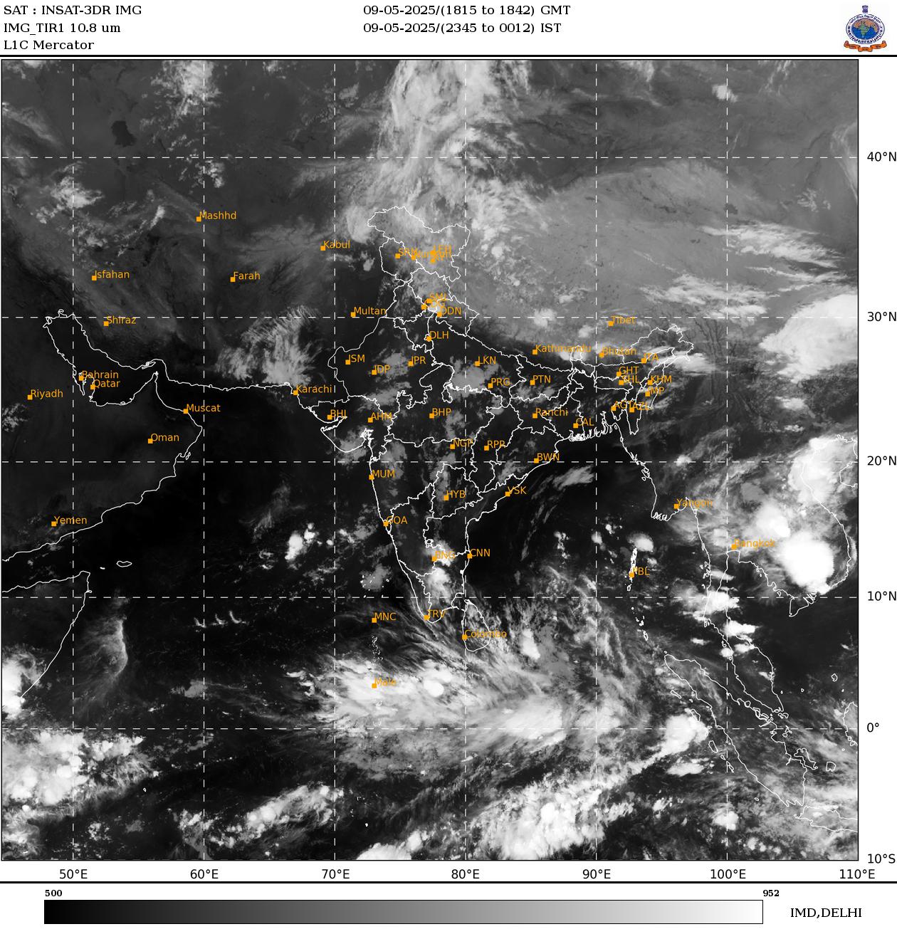
The latest image recieved from India Meteorological Department showing clouds position.
Weather in Northeast India
Northeast India, known for its dense vegetation and hilly terrains, often faces heavy rainfall during the monsoon. Under the influence of these weather systems, extremely heavy rainfall (≥21 cm) is very likely at isolated places over Arunachal Pradesh on 08 August. Light to moderate rainfall at many places accompanied by thunderstorms, lightning, and isolated heavy rainfall is likely to continue over Arunachal Pradesh, Assam and Meghalaya, Nagaland, Manipur, Mizoram and Tripura during 07-13 August, with isolated very heavy rainfall over Arunachal Pradesh during 07-12; Assam and Meghalaya on 07, 08, 12 and 13; Nagaland, Manipur, Mizoram and Tripura on 07 and 08 August. This situation may increase the risk of local flooding and landslides, so residents are advised to remain vigilant.
Weather in Northwest India
Northwest India, including the Himalayan region and plains, is influenced by Western Disturbances that bring cool winds and rainfall. Isolated heavy rainfall is likely over Uttarakhand and Himachal Pradesh during 07-13; Haryana on 11; Uttar Pradesh on 07, 08 and during 11-13; Jammu and Kashmir on 13 August, with very heavy rainfall over Himachal Pradesh and Uttarakhand during 10-13 and East Uttar Pradesh on 12 and 13 August. Light to moderate rainfall at many places accompanied by thunderstorms and lightning is likely over the Western Himalayan region and many or some places over the plains during the next 7 days. This weather can be beneficial for crops but may impact road traffic and tourism.
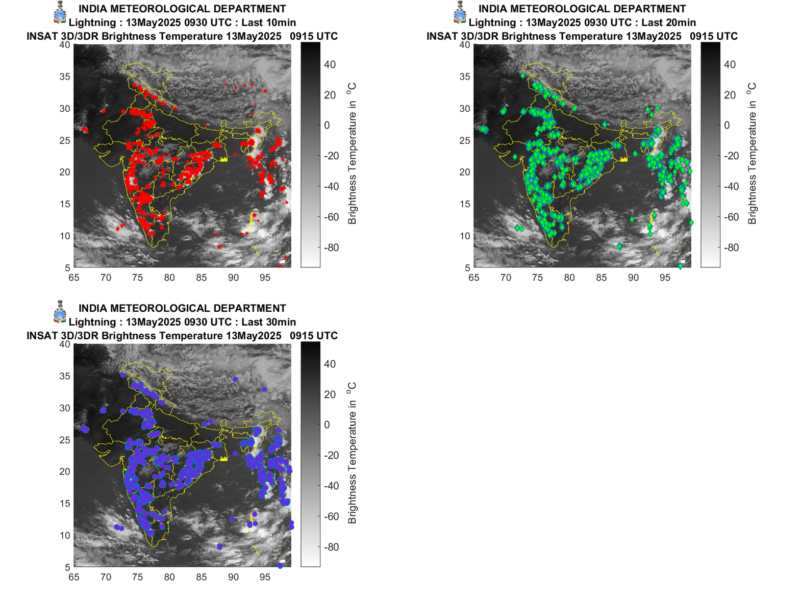
The latest image recieved from India Meteological Department showing incidence of ligtnening.
Weather in South Peninsular India
South Peninsular India, reliant on its coastal climate and agriculture, receives moisture from the Bay of Bengal. Isolated heavy rainfall is likely over Tamil Nadu, Telangana, Rayalaseema during 07-09; Kerala and Mahe, Karnataka, Coastal Andhra Pradesh and Yanam on 07 and 08 August, with very heavy rainfall over Tamil Nadu on 08 August. Strong surface winds (speed reaching 40-50 kmph) are very likely over South Peninsular India during the next 2 days. Light to moderate rainfall at some places accompanied by thunderstorms and lightning is likely over Tamil Nadu, Kerala and Mahe, Lakshadweep, Karnataka, Rayalaseema, Coastal Andhra Pradesh and Yanam, and Telangana during the next 5 days. This condition may affect fishing and agricultural activities.
Weather in East and Central India
East and Central India, encompassing the Gangetic plains and sub-Himalayan areas, receives rainfall due to the monsoon trough. Isolated heavy rainfall is likely over Sub-Himalayan West Bengal and Sikkim during 07-13; Odisha during 07-09; Bihar during 07-09, 12 and 13; Gangetic West Bengal and Jharkhand on 07 and 08; Chhattisgarh during 11-13; Andaman and Nicobar Islands on 11; Vidarbha on 13 August, with isolated very heavy rainfall over Bihar on 08; Sub-Himalayan West Bengal and Sikkim on 07 and 11 August. Light to moderate rainfall at most or many places accompanied by thunderstorms and lightning is likely over the region during the next 5 days. This weather may heighten flood risks, especially in river valleys.
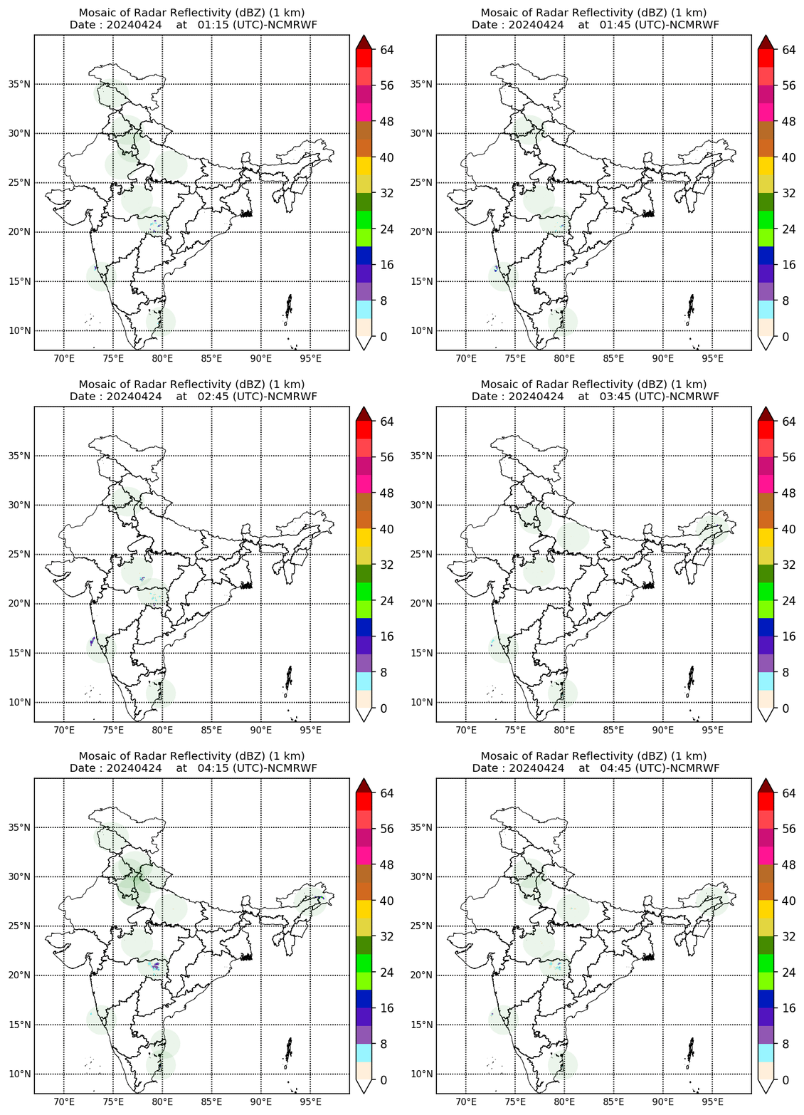
Dynamic Image recieved from India Meteorological Department Showing Radar Reflectivity
Weather in West India
West India, including coastal areas like Konkan and Goa, draws moisture from the Arabian Sea. Isolated heavy rainfall is likely over Marathawada on 07 and 08; Konkan and Goa on 07, 08, 12 and 13; and Madhya Maharashtra on 07 August. Light to moderate rainfall at many or some places is very likely over the region during the next 5-6 days. This situation may influence local agriculture and urban flooding.
Fishermen Warning
Due to the weather systems, risks in marine areas have increased, which is crucial for fishermen’s safety. Fishermen are advised to avoid venturing into the following areas from 07 August to 12 August 2025:
Arabian Sea – few parts of Northwest Arabian Sea adjoining Oman coasts during 08 to 12 August, some parts of southwest and westcentral Arabian Sea; along and off the Somalia coast and adjoining sea areas during 07 to 12 August.
Bay of Bengal – along and off north Odisha and West Bengal coast adjoining northwest Bay of Bengal on 07 August and over some parts of Gulf of Mannar adjoining Comorin area and over Sri Lanka coasts, few parts of southwest Bay of Bengal during 07 to 12 August. This warning is issued due to strong winds and high waves that can make navigation dangerous.